Visualizations for Terrain Shaping
Company:
Autodesk, Inc.
Role:
Principal Experience Designer
Dates:
2013 - 2015
Description:
My teams on Autodesk InfraWorks were charged with creating a more flexible and comprehensive approach for site planning and terrain shaping. I brought more accessible and visceral interactive visualizations to solve these challenges.
In civil engineering, site planning is the process of deciding how parcels of land will be used and encompasses zoning, access, drainage, circulation, privacy, security, shelter, and other factors. This is accomplished by utilizing landform, landscaping, water features, buildings, and paving. Site planning heavily overlaps with terrain shaping & grading. Terrain shaping is the task of ensuring a level base, or one with a specified slope, for construction work such as water drainage, landscaping, or a foundation for buildings, roads, or parking lots.
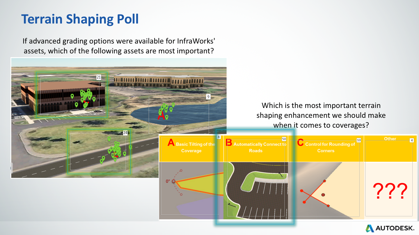
In the project’s discovery phase, the PO and I conducted formative research to crystalize the customers’ problems and ascertain the customers’ priorities. The results of these engagements, as seen in the Grading Visualization and the Feature Prioritization, connected our team to our customers’ viewpoint.
In the definition phase, the product team combined the results from the formative research with the team’s design, business, and engineering perspectives to generate a vision, goals, and an initial list of MVP functionality.
In the ideation phase, I gathered prior art for inspiration, brainstormed, built wireframes with XD colleagues, created Unity prototypes, and presented these ideas to the product team. As one inspirational approach to presenting metadata in a complex 3d scene, I walked the team through the CryEngine Sandbox Editor. Aspirational mockups were generated for site planning and iterated upon to match various business and technical constraints. I created simple, targeted, interactive Unity-based prototypes showing ways of displaying hover/selected states for objects in 3d scenes and one way of showing visual differences between different design options. Structured design sessions with XD colleagues resulted in other visualizations of terrain views with editing options.
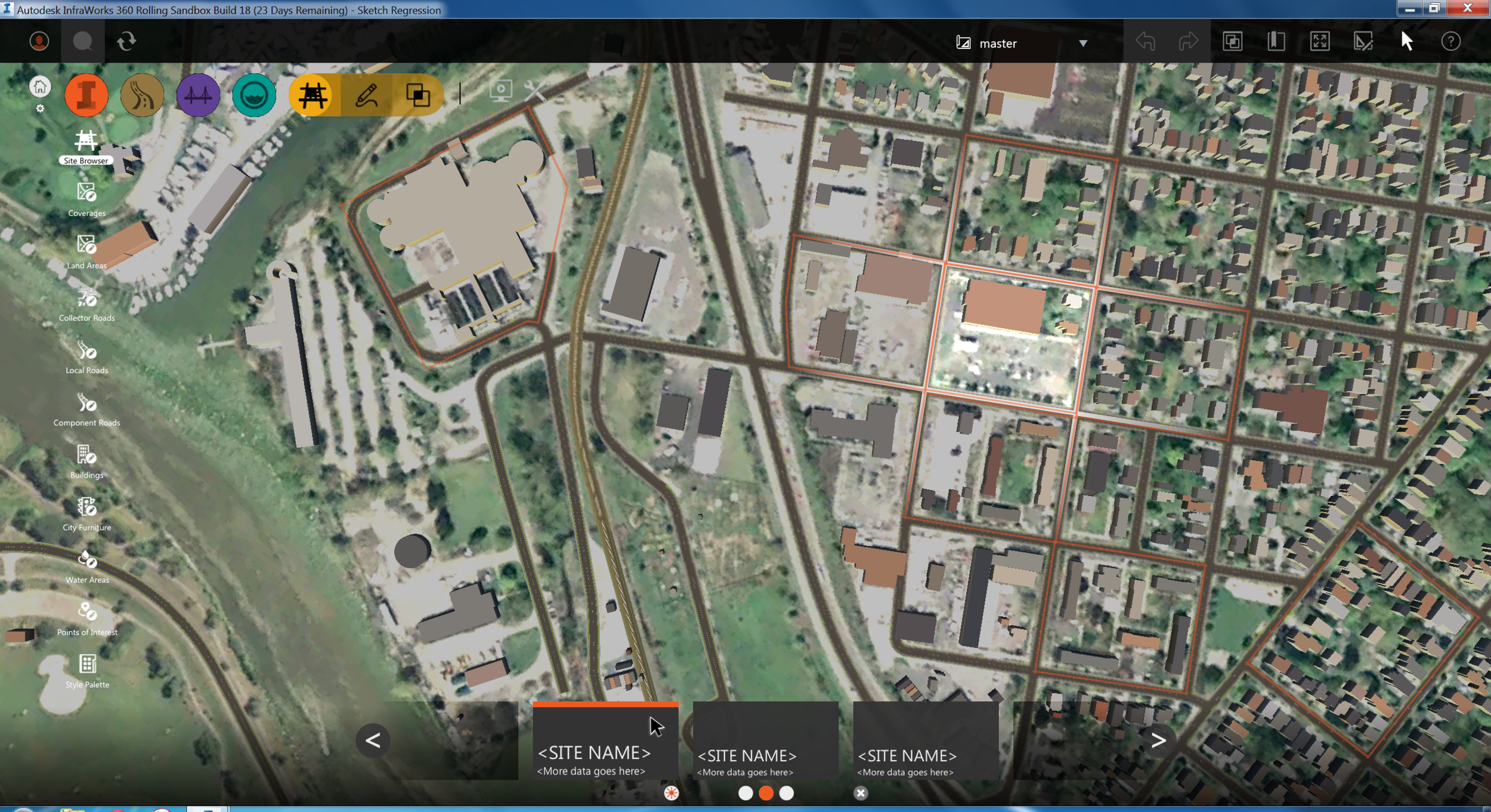
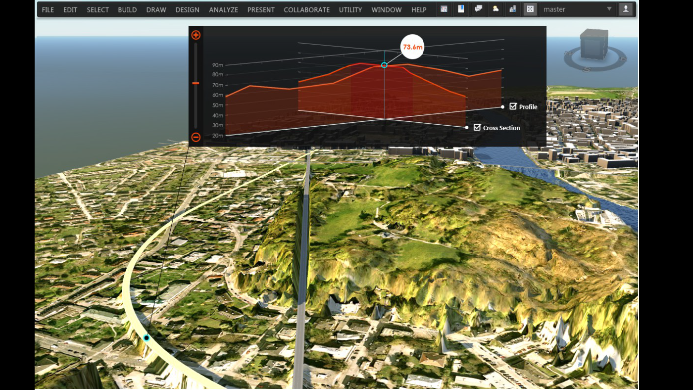
While standard 2d UI patterns were utilized, clearer and more elegant 3d in-scene interactive visualizations were applied to many design challenges including site visualizations (including buildings, parking lots, and grading contour lines) and in-scene manipulation of roadside grading zones.